- Boat InsuranceBoat Insurance
We’re proud to say our boat insurance is among the best in the business. We cover many different types of vessel, so you’re sure to find the right cover for your craft.
- Barge InsuranceBarge Insurance
Protect your barge from waterway mishaps with our top-notch boat insurance policies. Go for ‘Base Layer’ if you just want third party protection, and ‘All Weather’ for comprehensive cover.
- Commercial Boat InsuranceCommercial Boat Insurance
When your boat is your livelihood, the stakes are very high, so it’s crucial to choose the right insurance. Discover our Commercial ‘All Weather’ policy, created especially for business boats like yours
- Dinghy InsuranceDinghy Insurance
Whether you use your dinghy for racing or recreation, you’ll want to know you’re fully covered when you set sail. Check out our policies and see what floats your boat.
- Inland Cruiser InsuranceInland Cruiser Insurance
When you own an inland cruiser, the world’s waterways are your oyster. But it’s best to plan for the unexpected, as even on a day trip, anything can crop up.
- Motorboat InsuranceMotorboat Insurance
At Haven Knox-Johnston, we’ll help you make lighter work of insuring your motorboat. Check out our policies, and why not get a free motorboat insurance quote today?
- Houseboat InsuranceHouseboat Insurance
Whether your houseboat is a place you call home, or holiday getaway, we’ve got you covered.
- Narrowboat InsuranceNarrowboat Insurance
Variety is the spice of life, and for narrowboat owners, that’s especially true. So you’ll want boat cover that’s flexible enough for whatever crops up, from a team that really knows the ropes.
- RIB InsuranceRIB Insurance
Whatever you use your RIB for, one thing’s certain – your boat insurance needs to be as hard-working as your boat. And when you take a policy with Haven Knox-Johnston, rest assured it will be.
- Speedboat InsuranceSpeedboat Insurance
These boats are all about excitement – and when you’re insuring your speedboat, you need cover that can keep up. That’s where we come in. Why not get a quote today?
- Yacht InsuranceYacht Insurance
You can’t beat the yacht life, but it’s no secret it’s not the cheapest of passions. With our in-depth knowledge of the yachting sector, we’re perfectly placed to protect your price and joy.
- Personal Watercraft InsurancePersonal Watercraft Insurance
If you’re looking for insurance for your watercraft, but it doesn’t quite fit the mould of a standard boat like a yacht or a motorboat, then we’ve got you covered.
- Marine Trade InsuranceMarine Trade Insurance
- Barge InsuranceBarge Insurance
- Existing CustomersExisting Customers
Nice to see you – hope all’s well.
- Renew my policyRenew my policy
Non EEA Customers can renew their boat insurance policy with Haven Knox-Johnston
- Report a claimReport a claim
Need to make a Claim? please complete the form and attach any information
- Buddy’s BenefitsBuddy’s Benefits
Share the love and refer us to your shipmates. If they jump onboard, then you will both receive £20 Amazon Voucher!
- Loyalty SchemeLoyalty Scheme
Boat insurance with benefits
- FAQsFAQs
All your boating questions answered
- BrexitBrexit
What it means for you
- BrexitBrexit
- Renew my policyRenew my policy
- Other StuffOther Stuff
News, true stories and expert insights from the HavenKJ crew
- AboutAbout
Find out what we stand for
- Our HistoryOur History
Throughout our history, we’ve never stood still
- About your CrewAbout your Crew
The insurance crew who really care.
- Meet Maidstone crewMeet Maidstone crew
Your first port of call
- Meet Maidstone crewMeet Maidstone crew
- Feefo FeedbackFeefo Feedback
Want to know a little bit more about our Platinum standard services? Just click through to see what our customers say about us!
- Robin Knox-JohnstonRobin Knox-Johnston
The star of the high seas
- Our HistoryOur History
- Haven KJ on TourHaven KJ on Tour
Boat events not to miss
- Aqueduct Marina Boating Event - OverviewAqueduct Marina Boating Event - Overview
Overview of the Aqueduct Marina Boating Event
- Barclays Jersey Boat Show - OverviewBarclays Jersey Boat Show - Overview
Overview of the Barclays Jersey Boat Show
- Crick Boat Show – OverviewCrick Boat Show – Overview
Overview of the Crick Boat Show event
- Dartmouth Royal Regatta - OverviewDartmouth Royal Regatta - Overview
Overview of the Dartmouth Royal Regatta Sailing Week
- Kip Regatta - OverviewKip Regatta - Overview
Overview of the Kip Regatta
- Round the Island Race – OverviewRound the Island Race – Overview
Overview of the Round the Island Race
- Southampton International Boat Show – OverviewSouthampton International Boat Show – Overview
Overview Southampton International Boat Show event
- Thames Traditional Boat Festival - OverviewThames Traditional Boat Festival - Overview
Overview of the Thames Traditional Boat Festival
- Thames Valley Boat Show - OverviewThames Valley Boat Show - Overview
Overview of the Thames Valley Boat Show
- International Paint Poole Regatta - OverviewInternational Paint Poole Regatta - Overview
International Paint Poole Regatta
- TYHA Marina Awards 2025TYHA Marina Awards 2025
Overview of the TYHA Marina Awards
- Aqueduct Marina Boating Event - OverviewAqueduct Marina Boating Event - Overview
- SustainabilitySustainability
Sail smarter: Protect our waters
- Where’s IanWhere’s Ian
Boat Events not to miss
- Azores and BackAzores and Back
Ian and his crewmate, Pete from ‘Haven KJ Enigma’ are attempting to complete the challenging MailASail Azores and Back race.
- Azores and BackAzores and Back
- Other ProductsOther Products
Find out what else we can shipshape for you!
- Abode Home InsuranceAbode Home Insurance
Fancy some great quality home insurance? Then look no further, we have access to some great products including home insurance.
- Lark MusicLark Music
Get finely tuned Musical Instrument insurance with a 10% discount for the HK-J community
- Private ClientsPrivate Clients
Protect your other prized possessions from the unthinkable. Welcome to Howden Private Clients
- Abode Home InsuranceAbode Home Insurance
- A-Z of Nautical TermsA-Z of Nautical Terms
A glossary of boat terminology and abbreviations
- Buddy’s Marina GuideBuddy’s Marina Guide
Explore our interactive map of all the marina’s in the UK to find your next mooring spot.
- Cruising Range MapsCruising Range Maps
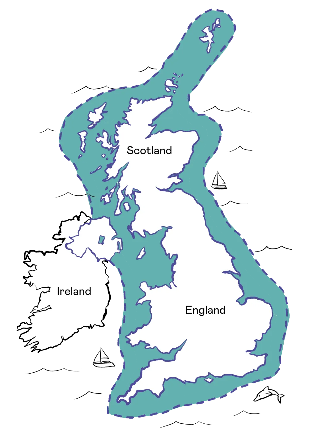
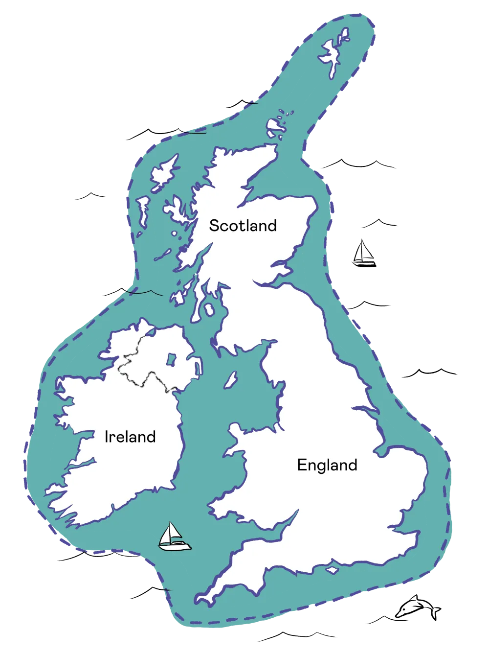
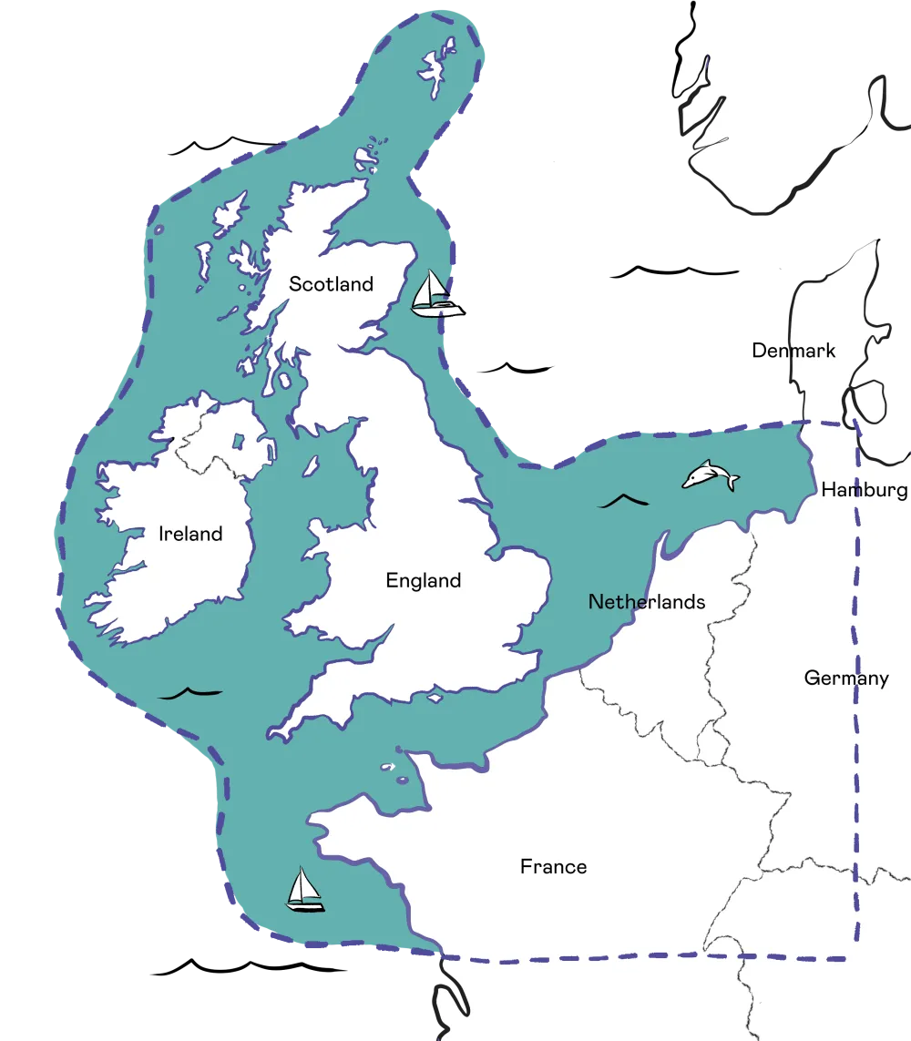
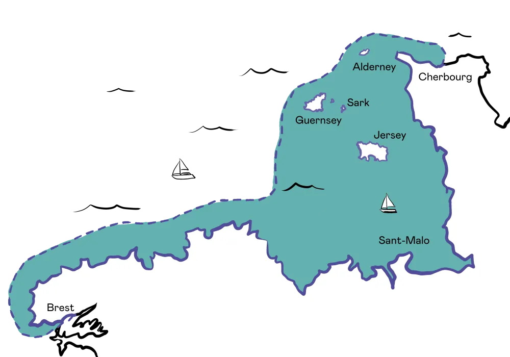
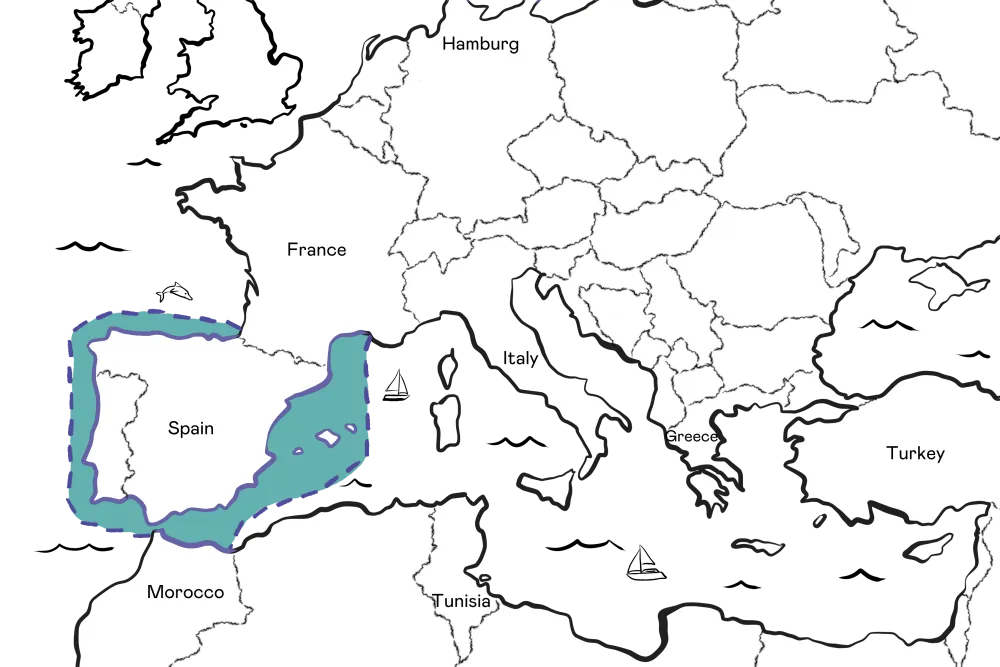
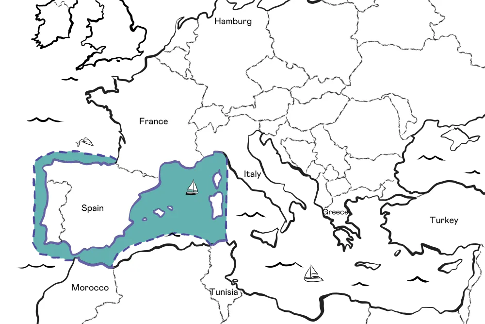
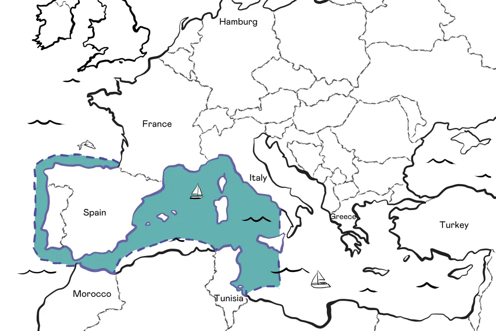
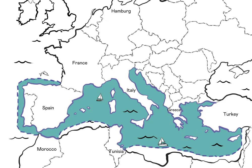
A list of our cruising range maps with explanations
- BrokersBrokers
At Haven Knox Johnston our broker partners are essential to our future and we look forward to continuing to offer great products, excellent service and competitive terms to help you look after your clients.
- AboutAbout
- NewsNews
News, true stories and expert insights from the HavenKJ crew
- HKJ CommercialHKJ Commercial
- Get a QuoteGet a Quote
- Renew my PolicyRenew my Policy
- Make a claimMake a claim
We’ll get you back on the water
- Contact UsContact Us
Contact us
